Study Concludes that Dominion Understates Pipeline’s Landslide Potential in Nelson County
From the Friends of Nelson County, Staunton, VA, March 13, 2017
A study of the potential for slope failures and landslides in Nelson County, VA from the proposed Atlantic Coast Pipeline, coupled with a review of Dominion’s in-house analysis, has concluded that “Dominion has not adequately identified those soils and landforms that are prone to debris flows (and) landslides.” The report also states that “the potential for debris flows in the very steep mountainous portions of Nelson County is underestimated by the reports submitted to FERC by Dominion.”
The author of the report, Blackburn Consulting Services, LLC, was contracted to review, assess, and comment on information submitted by Dominion to the Federal Energy Regulatory Commission (FERC), as related to the construction and operation of the proposed Atlantic Coast Pipeline (ACP) through Nelson County. The review was limited to information pertaining to soils/soil structure and slope stability, as well as the associated geohazards and erosion/water quality concerns that the ACP project raises for Nelson County.
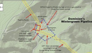
As part of their work, Blackburn developed a series of predictive maps to better identify the areas with high debris flow potentials and spent three full days in Nelson County traveling to 17 pre-determined sites along the pipeline route to ground-truth their model. In addition to their visual assessments of the terrain in those areas, four hand-auger borings were performed, and full soil descriptions were completed from 14 soil pits dug using a mechanical excavator. Three of the sites were located near the Wintergreen entry on Rt. 664—proposed as the exit point for a 4500-foot tunnel through the Blue Ridge—where they found evidence of a history of numerous debris flows.
Blackburn also reviewed documents submitted by Dominion to FERC through December 1, 2016. Soil scientists looked at the information Dominion was using to determine the pipeline route, soil types along that route, slope stability and erodibility.
The scientists found that Dominion has been using inadequate and inappropriate data sets to assess the soils and identify the landslide risk potential along the pipeline route in Nelson.
The report states: “(The) review has discovered that, due to the reliance on this regional-based and publicly available information, many of the statements made in Dominion’s FERC filings represent gross generalities. Dominion has not adequately identified those soils and landforms that are prone to debris flows/landslides, nor have they adequately addressed how they plan to mitigate those site-specific hazards that can put people, property and water quality at extreme risk.”
“Given the types of soils that the soil/scientists observed during their site work on Nelson’s steep slopes (loose uncompacted soils on slopes that measured as steep as 83%), it is obvious that the erosion potential of these slopes is much higher than Dominion is reporting,” said Randy Whiting of Friends of Nelson. “Considering the anticipated difficulties Dominion is expected to have with revegetating the pipeline right-of-way—both during and after construction—it becomes apparent that combining Nelson’s soils, slopes and this proposed pipeline is a recipe for disaster.”
“After reading this report, what scares me even more are the places where they want to install the pipeline along our narrow ridgetops,” said Joyce Burton of Friends of Nelson, referring to ridgetops such as those on Roberts Mountain. “There is no way to clear and flatten a 125’ construction right-of-way on a ridge that is only 60’ feet wide without severely impacting the landslide-prone slopes on either side.”
“We are calling on FERC to rescind the current DEIS and demand that Dominion follow these scientists’ recommendations to perform a more thorough assessment of the landslide risks in Nelson before the approval process is allowed to proceed any further,” Burton concluded.
Blackburn Consulting Services, LLC has over 50 years of experience in mapping and evaluating soil characteristics for a variety of purposes—ranging from agriculture and forestry to land development, environmental and wastewater disposal. They are licensed Professional Soil Scientists and On-site Soil Evaluators in the State of Virginia and nationally certified through the Soil Science Society of America.
The report was a joint project of Friends of Nelson, Friends of Wintergreen and Wintergreen Property Owners Inc.
The full report is available at: http://friendsofnelson.com/wp-content/uploads/2017/03/Final-Steep-Slope-Report-March-2017.pdf

