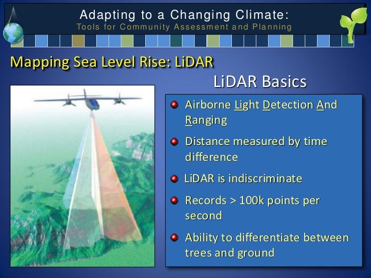
LIDAR Applications Include Coastal Analysis of Sloping Terrain
From an Article by Olivia Rosane, EcoWatch Report, June 30, 2021
Close to half a billion people could be in the path of sea level rise by 2100, a first-of-its-kind analysis has shown.
The study, published in Nature Communications on June 29th found that 267 million people currently live on land that is less than two meters (approximately 6.6 feet) above sea level, the range that is the most vulnerable to rising water levels. By 2100, the number at risk could climb to 410 million people.
“These numbers are another wake-up call about the immense number of people at risk in low-lying areas, particularly in vulnerable countries in the global South, where people are often experiencing these risks as part of a toxic mix with other risk factors, currently also including Covid-19,” Intergovernmental Panel on Climate Change (IPCC) contributing lead author Maarten van Aalst, who was not involved with the study, told The Guardian in response to the results.
Beyond its urgent warning, the new study was notable because of how it took land elevation into account. “Coastal flood risk assessments require accurate land elevation data,” the study co-authors wrote. “Those to date existed only for limited parts of the world, which has resulted in high uncertainty in projections of land area at risk of sea-level rise.”
To solve this problem, the Netherlands-based researchers used the first-ever model of worldwide elevation based on satellite LiDAR data. LiDAR is a method for measuring elevation by pulsing laser light down to Earth’s surface, the Nature Publishing Group explained in a press release. It has not been used before partly because it is difficult to access for much of the world.
“In some countries like the Netherlands, or parts of the UK, and much of the U.S., they have excellent data for these coastal zones, because they fly Lidar every four years. It costs tens of millions of euros just to cover the Netherlands. Obviously in much of the world, people don’t have that kind of funding,” study author Dr. Aljosja Hooijer of the think-tank Deltares told The Guardian.
Finally using this data enabled the researchers to understand how many people were already vulnerable to climate-crisis-driven flooding, which is caused both by rising sea levels and increasingly severe storms, the press release explained.
The 2100 projection was based on assuming zero population growth and sea-level rise of one meter (approximately 3.3 feet) by the century’s end, caused by a combination of increased ocean levels and land subsidence.
In addition to the study’s overall findings, the researchers also investigated which regions are and will be most impacted. Risk is heavily concentrated in tropical Asia. Today, 62 percent of the most at-risk land is in the tropics. Indonesia stood out as the country currently with the most vulnerable land. Outside of Asia, the Niger Delta and Lagos were also vulnerable, Hooijer told The Guardian. By 2100, 72 percent of the people most in danger will live in the tropics and 59 percent in tropical Asia specifically.
For Hooijer, the study highlighted the fact that people around the world are already experiencing the impacts of climate change as it interacts with sea level rise. “There’s a lot of scientists looking at long-term scenarios. But it’s happening now in parts of the world, and in these parts of the world, mostly in the tropics,” Hooijer told The Guardian.
#######…………………#######…………………#######
See also: Mapping Sea Level Rise: Tools for Community Assessment and Planning, Christopher Damon, Environmental Data Center, University of Rhode Island and Pam Rubinoff, Coastal Resources Center, University of Rhode Island
