The series features topics in Clean Water, Ecosystem Restoration, Education, Transportation, Flood Control and Recreation
Join us for our next discussion on …… register now!
§ “Understanding Microplastics in the Ohio River Basin” §
Tuesday, April 27, 2021, 12:00-1:00 pm (eastern time)
>>> Souhail Al-Abed, Ph.D., USEPA
Souhail will present “General Perspectives on Detecting and Characterizing Microplastics in Urban Watersheds”.
>>> Sherri “Sam” Mason, Ph.D., Penn State Behrend
Sam will present “The Perils of Plastic: Human Impacts and Solutions”.
Register for the webinar:
http://www.orsanco.org/ohio-river-discussion-series-registration/
The Ohio River Discussion Series is sponsored by the Ohio River Basin Alliance, The Ohio River Recreation Trail, ORSANCO, the National Park Service and the Foundation for Ohio River Education.
Ohio River Valley Water Sanitation Commission (ORSANCO)
5735 Kellogg Avenue, Cincinnati, OH 45230
(513) 231-7719, info@orsanco.org
www.orsanco.org
>>>>>>………………>>>>>>………………>>>>>>
See also: Ohio River Valley Water Sanitation Commission | ORSANCO
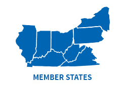
Since 1948, ORSANCO and its member states have cooperated to improve water quality in the Ohio River Basin, ensuring the river can be used for drinking, industrial supplies, and recreational purposes; and can support a healthy and diverse aquatic community. ORSANCO operates monitoring programs to check for pollutants and toxins that may interfere with specific uses of the river.


{ 2 comments… read them below or add one }
Bimonthly Water Quality Sampling – ORSANCO
The Bimonthly Water Quality Sampling Program is ORSANCO’s long-term water quality monitoring program for the Ohio River. The monitoring program began in 1975 and has a continuous record through the present day at 29 locations: 15 stations on the main stem of the Ohio River and 14 points near the mouth of major tributaries. The program’s six-sample annual design provides long-term trend monitoring of the Ohio River while maintaining an ability to evaluate attainment of water quality criteria. Samples are collected every second month, in January, March, May, July, September, and November.
Water Quality Parameters
Ammonia as Nitrogen
Bromide
Chloride
Hardness (as CaCO3)
Nitrate Nitrite
pH
Specific Conductivity
Sulfate
Temperature
Total Dissolved Solids
Total Kjeldahl Nitrogen
Total Organic Carbon
Total Phenolics
Total Phosphorus
Total Suspended Solids
Sample Locations
Most samples are collected from United States Army Corps of Engineers Locks and Dams, the remainder are collected from bridge or bank locations. The Bimonthly Sampling Program Monitoring Stations are (Ohio River confluence mile points are given for tributary stations with tributary mile points enclosed in parenthesis):
Allegheny River at Pittsburgh, Ohio River Mile 0.0, (-7.4)
Monongahela River at South Pittsburgh, Ohio River Mile 0.0, (-4.5)
Beaver River at Beaver Falls, Ohio River Mile 25.4, (-5.3)
Ohio River at New Cumberland, Mile 54.4
Ohio River at Pike Island, Mile 84.2
Ohio River at Hannibal, Mile 126.4
Ohio River at Willow Island, Mile 161.8
Muskingum River at Marietta, Ohio River Mile 172.2, (-0.8)
Ohio River at Belleville, Mile 203.9
Kanawha River at Winfield, Ohio River Mile 265.7, (-31.1)
Ohio River at R.C. Byrd, Mile 279.2
Big Sandy River at Louisa, Ohio River Mile 317.1, (-20.3)
Ohio River at Greenup, Mile 341
Scioto River at Lucasville, Ohio River Mile 356.5, (-15)
Ohio River at Meldahl, Mile 436.2
Little Miami River at Newtown, Ohio River Mile 464.1, (-7.5)
Licking River at Covington, Ohio River Mile 470.2, (-4.5)
Great Miami River at Elizabethtown, Ohio River Mile 491.1, (-5.2)
Ohio River at Markland, Mile 531.5
Ohio River at McAlpine, Mile 606.8
Ohio River at Cannelton, Mile 720.7
Green River at Sebree, Ohio River Mile 784.2, (-41.3)
Ohio River at Newburgh, Mile 776
Ohio River at J.T. Myers, Ohio R. Mile 846
Wabash River at Route 62 Bridge, Ohio River Mile 848, (-32.5)
Ohio River at Smithland, Mile 918.5
Cumberland River at Pinkneyville, Ohio River Mile 920.4, (-16)
Tennessee River at Paducah, Ohio River Mile 934.5, (-6)
Ohio River at L&D 52, Mile 938.9 (this location to be phased out during 2018-2019)
Ohio River at Olmsted L&D, Mile 964.6
Grab Sample Methods
River water samples are collected as near to the centerline of the river as possible from lockchamber guidewalls, bridges, and in some cases from raw water intake lines. To sample from outside structures an acid, distilled, and native water-rinsed bailer, stainless steel bucket, or Kemmerer sampler is used with sufficient nylon rope attached to reach the river surface. Samples are transferred from the collection device to a likewise triple-rinsed ten-liter plastic carboy. The sample water is distributed from the carboy to sample bottles, each containing preservative if required by the analytical methods to be employed.
For more information on the Bimonthly Water Quality Sampling Program, please contact Ryan Argo.
http://www.orsanco.org/programs/bimonthly-water-quality-sampling/
NRC Report: No Chris Code – Black Smoke near Bulger, PA
Description: Incident Type: FIXED – NRC Report ID: 1303123 – Medium Affected: AIR – Suspected Responsible Party: MARK WEST
Incident Date/Time: 2021-04-20 17:20:00
NOTE: MARK WEST corporation operates huge processing facilities in Washington County PA to separate ethane and propane from raw natural gas.
CHRIS CODE — https://www.dco.uscg.mil/Portals/9/DCO%20Documents/National%20Strike%20Force/foscr/ASTFOSCRSeminar/References/CHRISManualIntro.pdf?ver=2017-09-15-105040-973